- Place
- Durana, Álava
- Year
- 2024
- Type
- Academic project

Description
On a privately owned plot in Durana, empty today, a new neighbourhood is proposed: the key is to give the village the main square it lacks, and public spaces of quality.
This is work for the Proyectos IV course (May 2024), done on my own. In Durana there is a privately owned plot that is empty today; a new neighbourhood is proposed there, and the key to the project is two aims: to give the village the main square it lacks and to create public spaces of quality.
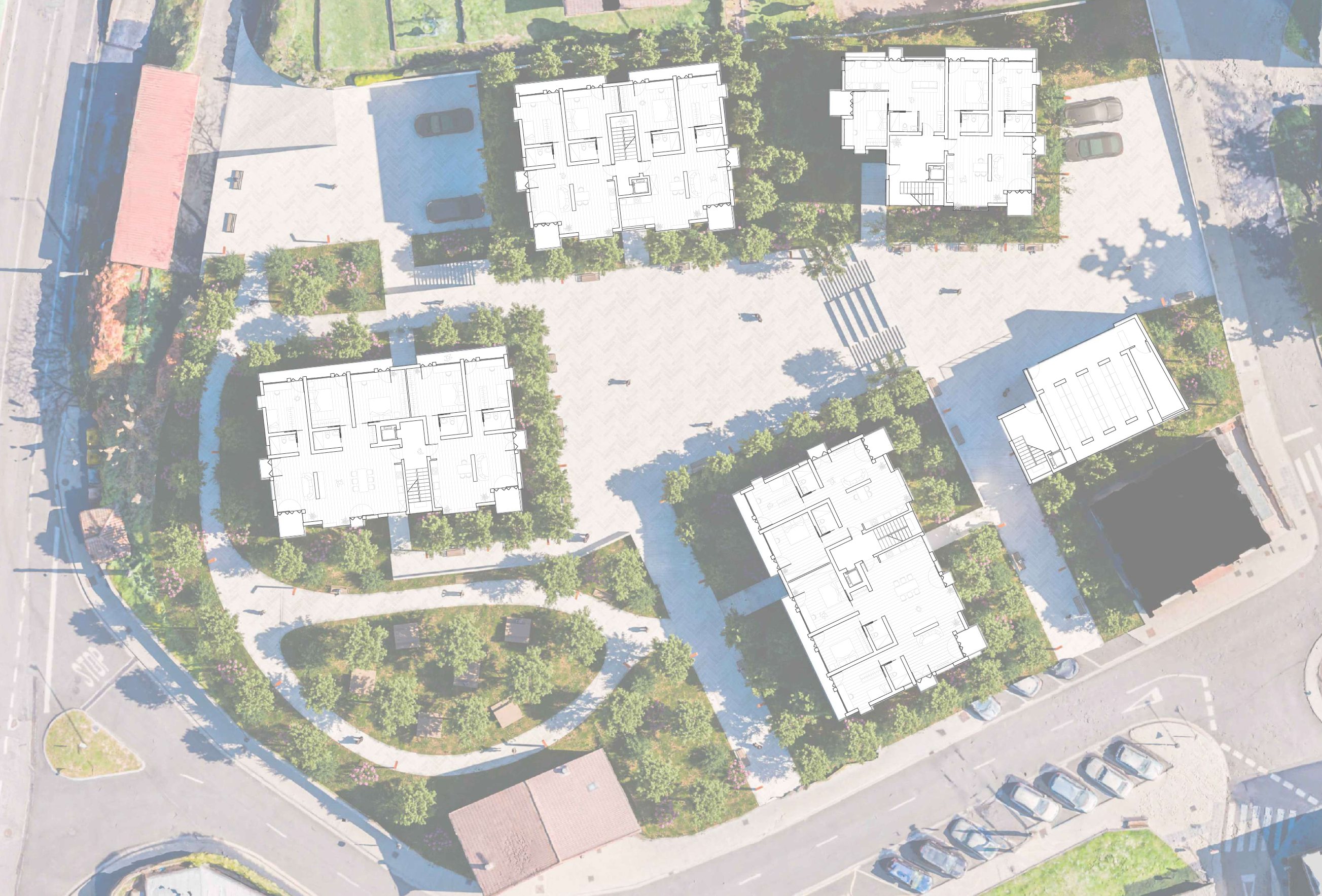
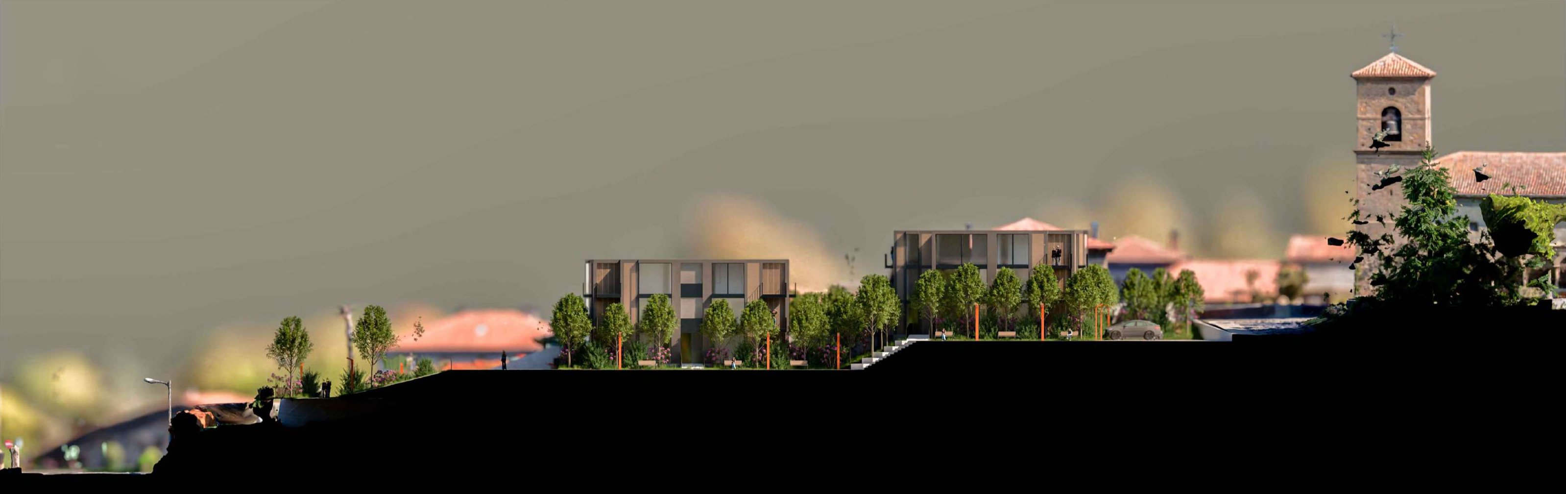
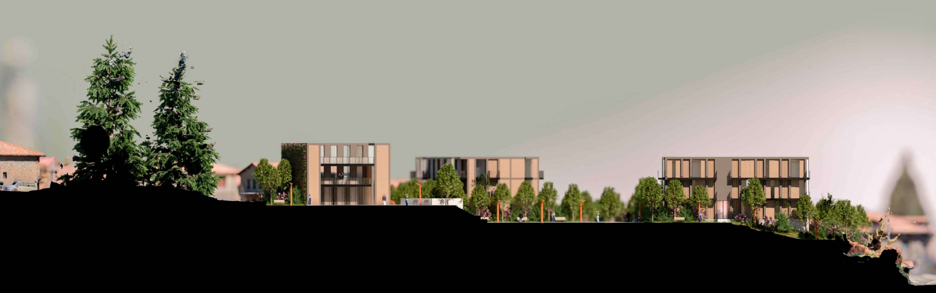
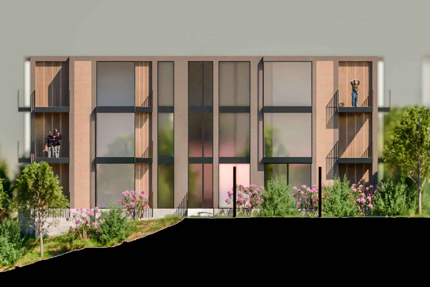
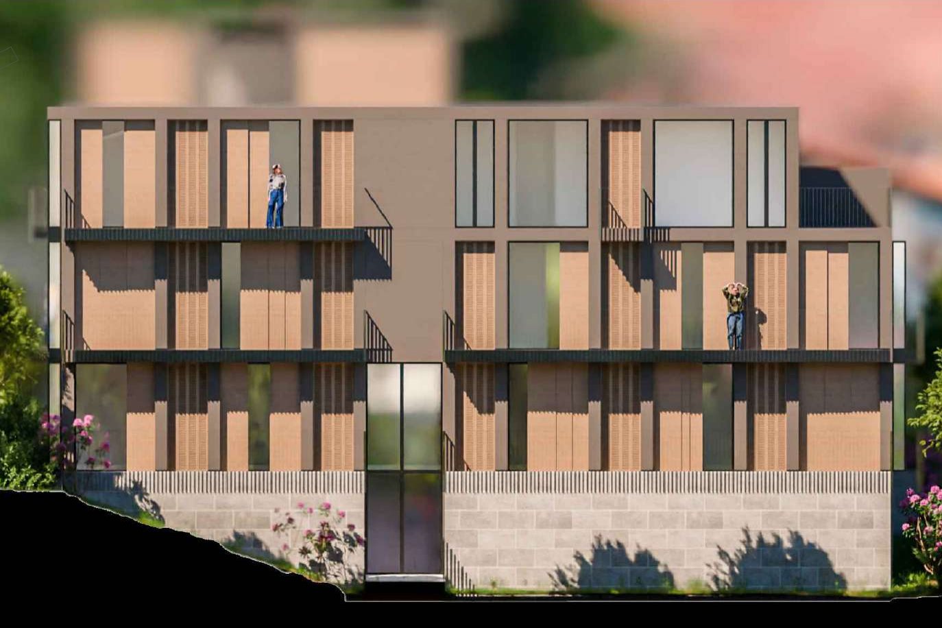
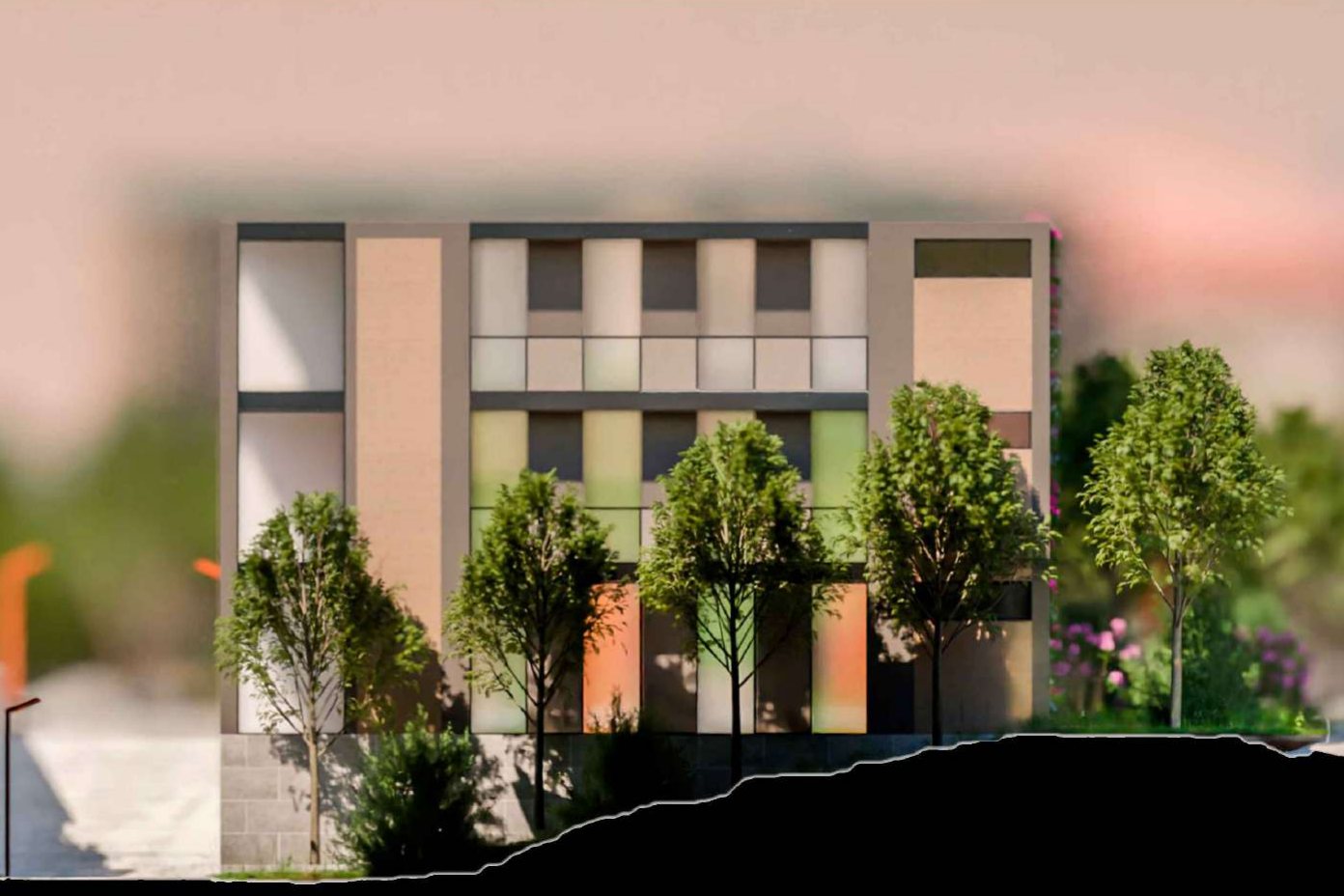
The neighbourhood is made up of four housing buildings and an amenity building (a public facility), around a square and a park. Parking is underground, to leave the surface free. The slope of the plot has not been corrected: it has become a tool of the project, and the buildings step up through different levels, between the 0 and 12 metre marks.
In designing the neighbourhood the sightlines were respected. The key to the process was obtaining a 3D model of the village through photogrammetry: the project was seen and decided on top of that model, and the sections and aerial views are also built on it.
Project decisions
- 01
An empty private plot
The plot lies in the village itself, is privately owned and is empty today. That gap is the starting point of the project.
- 02
The main square that is missing
The village lacks a main square. The key to the project is to give it one and, with it, public spaces of quality: the square and the park.
- 03
Working with the slope
The slope was not taken as an obstacle but as a tool: the buildings sit at different levels, and levels and steps organise the square and give the neighbourhood interesting routes and views.
- 04
Different housing types
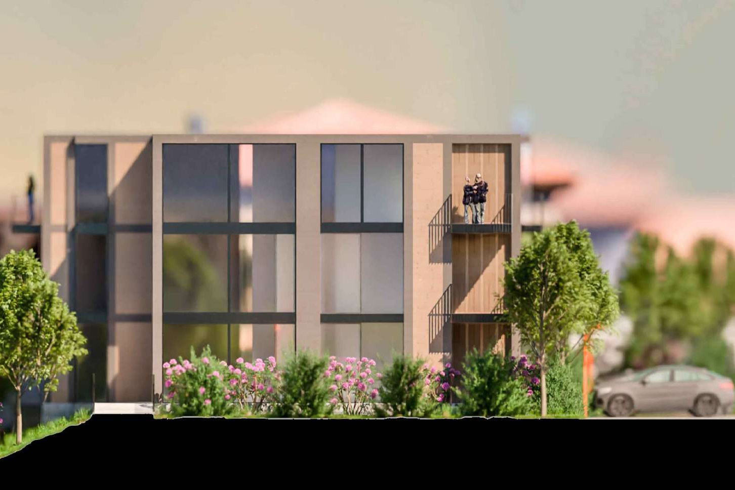
The four housing buildings are not the same: they have different types, each adapted to its height and its place.
- 05
A public facility
An amenity building is included in the neighbourhood, at the edge of the square, so that it is not only residential: something that gives life to the public space.
- 06
Respecting the sightlines
In designing the neighbourhood the sightlines were respected. From the square, for example, the church tower can be seen.
- 07
A 3D model of the village, by photogrammetry
The key to the process was obtaining a 3D model of the village through photogrammetry. The project was worked on top of it: the plot, the slope, the roofs and the sightlines are seen together with the real village.
Images
By day


By night


Drawings
Plan
Sections
Elevations
«Infernuraino, euskal kulturaz hitz egitera joango banintz.»“All the way to hell, if it were to speak of Basque culture.”
gartzeazaldua@gmail.com